Thursday, July 29, 2010

Hough's Neck, Quincy

photo of Hough's Neck, Quincy, MA
I do a lot of hiking, but not all of it is in the woods. Indeed, I take part in urban walks as well as walks near the ocean that are sometimes pieced together rather haphazardly. One such example of the latter is a walk we did recently in the Hough's Neck section of Quincy that took us through a variety of terrain, including salt marshes, placid beaches, and rugged oceanfront lands, as well as residential areas. We started our walk at Wollaston Beach in Quincy, heading south to the southern end of the beach where we took a left through some attractive, tree-shaded residential streets. We eventually ended up along the main drag that leads to Hough's Neck (Sea Street), crossing the street to a little-used trail that felt almost like a rail trail. This path formed the northern edge of some beautiful salt marshes that are hidden from view to most folks driving through this part of the city. The trail went on for a little under a mile, ending close to the ocean, where we walked north along a scenic beach (see photo) into the heart of Hough's Neck.

From the central area of Hough's Neck (which includes a restaurant called Louis' Crossing), we continued north on a couple of quiet streets, ending up at Nut Island, which is part of the Boston Harbor Islands National Recreation Area, though it is not technically an island, but rather a peninsula. The sweeping views from Nut Island include the Boston Skyline as well as many of the islands in Boston Harbor, and we spent a bit of time here having a snack and enjoying the nice weather. Then we took the short way back to Wollaston Beach, along roads on the north side of Hough's Neck that overlook the water.

If you're looking for a remote-feeling hike that goes through the woods or up steep hills, this is not the one for you. But if you enjoy ocean views (and would like to see what salt marshes look like), strolling through the Hough's Neck section of Quincy can certainly be a fun half-day walk.

Thursday, May 20, 2010

Sweeping Views from Buck Hill in the Blue Hills Revervation

photo of Wachusett Mountain from Buck Hill in the Blue Hills.
Awhile back, I had posted some information on one of the most popular spots in the Blue Hills Reservation south of Boston, namely Buck Hill. The summit of the hill has a nearly 360-degree view of the surrounding countryside, and on clear days, there is no telling how far in the distance you can see. On a recent hike up Buck Hill, several of us on the hike were surprised to see such a clear view of Wachusett Mountain, a 2,000-foot peak out in Central Massachusetts that is more than 50 miles from the Blue Hills. The photo here shows Wachusett in the background, taken using a powerful telephoto lens. It is not a rare occurence to see Wachusett from Buck Hill, but this was about the clearest view of it I have seen from the summit.

Monday, April 05, 2010

Fells Cascade, Middlesex Fells

photo of Fells Cascade, Middlesex Fells
Much of the western section of the Middlesex Fells Reservation consists of rolling hills and trails that are relatively easy to maneuver. But once you head into the Eastern Fells, the landscape changes a bit, with some areas that are very rugged. And one section along the extreme eastern edge of the reservation looks like something you might find in the White Mountains of New Hampshire, with extremely steep trails, rugged ledges, and a cascade that, especially in the spring, can be quite a site. Situated close to the beautiful Black Rock ledges and fanning out from a stream that cuts through the Eastern Fells between the Fellsway East and Washington Street, the Fells Cascade drops precipitously eastward toward a residential section of Melrose, and the trail that goes alongside it can be treacherous, especially if it is wet. The views from the bottom of the cascade (see photo) are some of the most interesting in the entire reservation.

The Fells Cascade can be reached via the Rock Circuit Trail from the Flynn Ice Rink in Medford as part of a longer hike, or from the Oak Grove T stop in Malden as a much shorter hike. There is limited parking along the Fellsway East as well, which allows hikers to reach this spot in a matter of minutes.

Saturday, March 27, 2010

Cedar Swamp, Essex

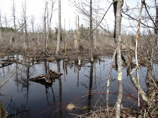
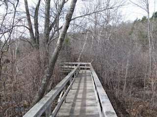
The North Shore has a number of areas in which to do hikes, including one that can either be done as an extremely short (and extremely scenic) boardwalk stroll or a much longer hike that includes deep woods and hills. This entry concentrates on the former, as one of the best parts of the extensive conservation land on the Essex-Manchester border is the cedar swamp that is within minutes of the start of the trailhead on Southern Avenue. The aforementioned boardwalk cuts through the heart of the swamp, with memorable views in all directions. The walk along the boardwalk only takes a few minutes, but there are so many good vantage points that you could easily spend an hour or more in the area, taking photos and looking for wildlife. For those who are looking for more of a workout, once the boardwalk ends a trail continues on, allowing for several miles of hiking over varied terrain.


Below are some photos of the cedar swamp, which by the way, is only a couple of minutes north of Route 128 (take the School Street exit).


photo of Cedar Swamp, Essex, MA


photo of Cedar Swamp, Essex, MA


photo of Cedar Swamp, Essex, MA