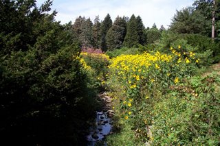


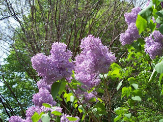
 A group of about 15 of us hiked through the Arnold Arboretum in Jamaica Plain, MA, several weeks back. It just happened to be the day before Lilac Sunday (which is held on Mother's Day), so we lucked out by getting to see lilacs in bloom without dealing with the crowds. Most lilacs that we saw were on the first part of the hike near Bussey Hill (see photo), with lilacs seemingly everywhere along the north side of the hill.
 As we hiked around, then up, Bussey Hill, we noticed many other plants and trees in full bloom in addition to all the lilacs. The colors seemed to be particularly spectacular this year. We wandered up various trails, finally reaching the top of Bussey Hill, taking in the beautiful views of the Blue Hills and the surrounding area from the partially open summit (see photo). After spending some time at the top of the hill, we wound our way down some trails, reaching the bottom of the hill near the Conifer Path. Most of the trees along the Conifer Path seemed to be healthy, though we did see a couple of larger pines that seemed to be either diseased or simply getting up there in age.
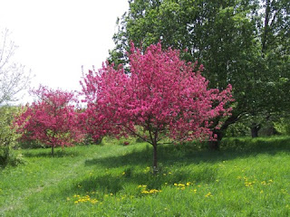 From the Conifer Path, we crossed the street to the other side of the Arnold Arboretum, gradually heading around Peters Hill before going up to the top. From the summit of Peters Hill, we could see the Boston skyline as well as much of the Arboretum in the foreground, making for an interesting scene (and a good place to stop for a bit). The north side of Peters Hill has many fruit trees, some of which were in bloom (see photo), so we took a few trails along the side of the hill before heading back to the bottom.
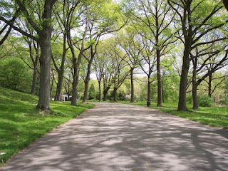 After reaching the bottom of Peters Hill, we took one of the main roads in the Arboretum (they are all closed to traffic, by the way), including a remarkably scenic stretch (see photo) before jumping onto a trail and heading back across the street to a trail that led up the little-known Hemlock Hill. We spent some time relaxing there, again enjoying the views of Boston in the distance. Then we headed down the hill and took a trail through an area of beech trees before taking our final trail, which led us through willow trees and maple trees. It was the end of what must have been one of the most scenic hikes I've taken in 2007. Hopefully I'll get back in the fall to see some of the foliage there.
 Great Meadows is an area of meadows, woods, and low hills that sits within the town of Lexington, but it actually owned by Arlington. Nearly 200 acres in size, much of Great Meadows is inaccessible, as it has no real trails and is mostly wetlands (see photo). There is, however, as series of trails mostly around the perimeter of Great Meadows, and it is possible to use trails and side streets to complete a loop around the area.
 A trail starts from the Minuteman Bike Path, in East Lexington just behind the intersection of Routes 4/225 and Massachusetts Avenue. This trail shifts between level boardwalks (see photo) and hilly dirt trails, going counter-clockwise around the west side of Great Meadows. Following the main trail, it eventually goes past some beautiful strands of birch (see photo below) for a short time before going up a hill with scenic views of the meadows as well as Lexington.
 From the top of the hill, the main trail drops into some deep woods, then skirts a school and eventually ends at a side street. By following a series of side streets back toward the bike path, the loop can be completed. One option is to take a right on a side trail off one of the side streets, which leads to a remarkable view of the meadows from its eastern edge. That trail then continues south to the bike path.
 Starting by the Gillette Plant in South Boston, the Harborwalk goes along the east side of the Fort Point Channel, going past South Station and the Boston Children's Museum. The stretch by the museum is particularly scenic, with striking views of the Boston skyline (see photo) as the walkway heads toward the end of the channel. From this point, the Harborwalk winds its way past the wealthy residences of Rowes Wharf and India Wharf. The next stop is the New England Aquarium and Long Wharf, both of which attract crowds of tourists.
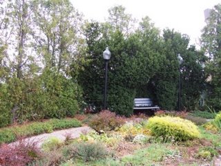 After Long Wharf and Christopher Columbus Park, the Harborwalk meanders up and down various wharves in the North End. One of the most interesting of these is Lewis Wharf, where people can relax at a little-known garden (photo), complete with benches and narrow walkways. This is one of the most peaceful spots along the Harborwalk, and is a beautiful spot during the summer when plants are in full bloom.
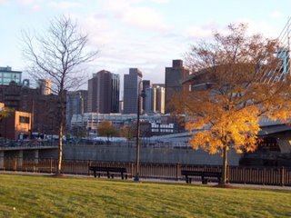 From Lewis Wharf, the path continues to wind along a few more wharves in the North End, though many users of the Harborwalk cut through the North End neighborhoods to see some of the interesting restaurants, shops, churches, and other points of interest, eventually meeting up with the Harborwalk near the Charlestown Bridge. From this point, there are a couple of options, one of which is to take a walkway over the Charles River Dam. Some of this walkway includes movable sidewalks over the dam. Now in Charlestown, the walkway emerges from the dam at Paul Revere Park (photo), a small area of open space with memorable views of the Zakim Bridge and the Boston skyline.
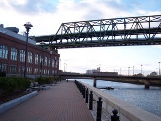 Continuing northeast along the water, the Harborwalk cuts past Tudor Wharf, then enters Boston National Historic Park and the Charlestown Naval Shipyard, where the U.S.S. Constitution is located. Going past Shipyard Park, the Harborwalk goes past a few more wharves and some quiet waterfront neighborhoods before coming to an end near Building 114 (photo) in the shadows of the Mystic Tobin Bridge. This vast building was once used for building boats for the navy, and now is a multi-use facility. It is open 24 hours a day, and has rest rooms, vending machines, and chairs and tables where people can relax before heading back along the Harborwalk.
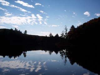 Connecticut may seem like a bit of a drive from Boston for someone looking for an easy, relaxing day of hiking, but the town of Union (and Bigelow Hollow State Park, which is within its borders) is only about an hour from the city. And the park is beautiful in ways that closer spots such as the Blue Hills and Middlesex Fells are not, since Union itself is in an unspoiled, hilly part of Connecticut.
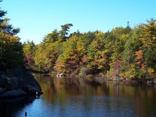
  Bigelow Hollow State Park and the adjacent Nipmuck State Forest together form a huge wilderness area of more than 9,000 acres. The state park itself has a couple of scenic bodies of water. Bigelow Pond (top) is the first one you reach along the road through the state park, and Mashapaug Pond (above and below) is the second one, which is found at the end of the road. Hiking trails go around Bigelow Pond and brush up along the border of Mashapaug Pond, with many more trails winding through the deep woods that extend all the way up to the Massachusetts border.
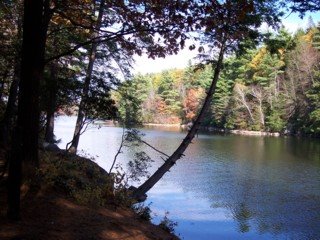 The trails in Bigelow Hollow State Park might not present much of a challenge to hikers, but if you like isolated ponds and scenic views of wooded hills and wetlands, Bigelow Hollow is definitely worth a trip.
 The Cape Cod Rail Trail is, as its name implies, a former railroad line that is now used mostly by bikers and rollerbladers. But this doesn't mean that this popular 22-mile trail that cuts through the center of the Cape is not used by anyone else. Indeed, walkers, joggers, and hikers can be seen on this path, enjoying the sights and sounds along the way, whether they are in Dennis, Harwich, Brewster, Orleans, Eastham, or Wellfleet.
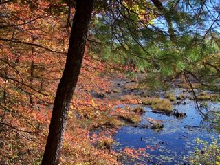 Did an 8-mile hike with more than 30 people the other day at Wompatuck State Park. It was an unusually warm October day, with temperatures approaching 80 degrees. Wompatuck is a mostly flat, wooded area with several ponds and an extensive network of trails as well as paved roads, some of which are off limits to cars.
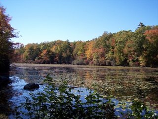 We went past some particularly scenic bodies of water, including Woodpecker Pond (above), which is near the visitor center, Boundary Pond (left), which is on the other side of the park near Norwell, and the remote, beautiful Heron Pond (bottom).
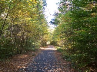 In addition to the scenic ponds in Wompatuck, there were also some interesting meadows and fields, as well as some particularly nice trails and roads, including one winding road that cuts through the center of the park (shown here), going past Wildcat Pond.
 There really isn't much in the way of scenic overlooks or high hills (none of either, to be honest) at Wompatuck State Park, but it is a fairly rugged, surprisingly remote area that extends through four towns, and is definitely a good spot to do some long-distance hiking without driving too far from Boston.
 Went on a hike a couple of weeks ago along the Reservoir Trail in the Western Middlesex Fells in Winchester and Medford. It was a decent-sized group, with about 15 of us on the hike. Part of the hike included a quick lesson on geocaching, as there are a couple of spots along the Reservoir Trail where items have been left for those who participate in this.
Some photos from a recent trip to the Arnold Arboretum:
Beech Tree Along the Beech Trail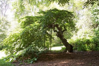
Rhododendron Path Near Lower Bussey Brook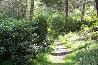
Upper Bussey Brook Near Hemlock Hill