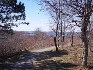
 We started at the Minute Man Visitor Center, which is just off Route 2A near where Lexington and Lincoln meet. We initially walked east, getting to the eastern end of the Battle Road Trail near Route 128, then going up the Fiske Hill trail to the top of the hill, where there is a peaceful meadow surrounded by woods (see photo). From there, we went down the other side and soon ended up back on the Battle Road Trail, heading west this time.
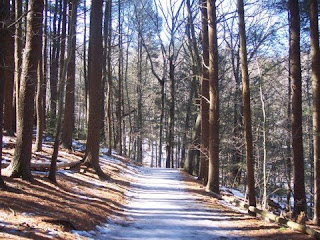
 After skirting the visitor center, we wound our way through a mix of woods and fields with Route 2A off to the left and Hanscom Field Airport nearby to the right. A little over a mile from the visitor center, we came to a beautiful tree-shaded stretch of the Battle Road Trail (see photo), stopping at the Hartwell Tavern for a short time before continuing on to the Bloody Angle, a few more historic structures, and a boardwalk before meeting up (briefly) with Route 2A near the Lincoln/Concord line.
 Walking away from Route 2A on the Battle Road Trail (and going past a farmstand that was unfortunately closed for the season), we soon ended up on another boardwalk that led to the historic farming fields (see photo), which is perhaps the most picturesque part of the Battle Road Trail. We looped around the fields, ending up back near Route 2A, then walked the short stretch marking the end of the Battle Road Trail. From here, we walked along Route 2A for a bit less than a half mile, stopping for lunch next to The Wayside and the Orchard House, just east of Concord Center.
 After lunch, we backtracked east along the Battle Road Trail, making a few stops at the historic farming fields, one of the boardwalks, and the Hartwell Tavern. By this time, the tavern was open to the public, so a few of us toured the historic home (see photo) before continuing on. From there, it was a relatively quick walk back to the visitor center and the cars. The total trip was around 13 miles, but a fairly easy 13 miles since much of the walk was flat.
The Battle Road Trail within the Minute Man National Historic Park isn't all that challenging, but it is very peaceful and scenic, and there is a lot of history to see along the way.



 A group of 25 of us went on a long hike through Hale Reservation in Westwood (and briefly crossed over into the Noanet Woodlands in Dover) a little more than a week ago. Hale is a huge reservation, so we went at a brisk pace from the start, looping northwest from the Cat Rock parking area over to the pristine Storrow Pond (see photo) near the northern edge of the reservation. After spending some time enjoying the sights of the pond and the sounds of the stream that fell away from it, we turned southwest, hiking through some of the most remote-feeling land in the Boston area along a part of the Storrow Pond Trail.
  After nearly a mile of walking through some very deep woods, we approached Powissett Pond (see photo), which is in the hilly western part of Hale Reservation. Like Storrow Pond, Powissett Pond is a small but scenic body of water, and we spent some time on the picnic tables there relaxing and wandering around the beach area. From there, we started climbing west toward the southwestern edge of the reservation, staying mostly on a fire lane trail, but eventually veering off to reach the highest point of the hike.
 After several fairly steep twists and turns along some minor trails, we made it to the top of Powissett Peak, which is about 400 feet above sea level and has some sweeping views to the west (see photo). It was a bit windy at the top, so we didn't stay long, backtracking to the fire lane and dipping down into the Noanet Woodlands where we had lunch. From there, we took some little-used trails east back into Hale, skirting Strawberry Hill and ending up back near Powissett Pond. From there, it was an easy (and scenic) walk back to the parking area via a trail that went alongside Noanet Pond, the biggest body of water in the reservation.
 There aren't too many "mountains" in the Boston area, so having the word attached to a recreation area, even if it's not accurate, is rather intriguing. And after finally hiking through the Wilson Mountain Reservation in Dedham last weekend, I can say that no, Wilson Mountain is not really a mountain, but it is a peaceful, scenic spot with deep woods, bubbling brooks (see photo), and a surprisingly steep hill with decent views at the top.
 We started our hike from the small parking lot (room for 10 cars or so) along Route 135 just east of Route 128. The green dot trail started out as what looked like a logging road, but it quickly became narrower and steeper once the red dot loop veered off to the right. As we skirted the top of the hill, some limited views of the Blue Hills could be seen to the east, but then we quickly lost the views as we descended into a deeply woooded are with many streams. A little more than halfway through the green loop, we took a side trail up to the red dot trail, where we took a right and were soon dropping steeply from the hill, on the part of the trail where the red and green dot were one and the same. Then the red dot trail left the green dot and passed through a beautiful pine forest (see photo) before starting a rather treacherous scamper up toward the summit of Wilson Mountain.
 Once we reached the summit, we took a breather, enjoying the fine views of the Boston skyline and the unusual rock formations at the top (see photo). Then we went back along the side trail down to the green dot trail where we continued on from where we had left off earlier. This part of the green dot was mostly flat and eventually went parallel to Route 135, but it was still quite nice, with several streams and some wetlands along the way. The trail took us back to the parking lot, but we continued on to another trail that skirted the eastern boundary of the reservation and led to a large meadow. From there, we turned around and headed back to the lot.
 Pond Meadow is a smallish park mostly in Braintree, though some of it is located in Weymouth. It abuts Route 3, so parts of the area are tarnished by traffic noise, but much of the area is quiet. There is a main walkway that is paved loops around the pond, with some dirt paths veering off the loop. We hiked on both the paved walkway and most of the dirt paths (except for the yellow trail), walking about 4 miles total, much of which was along or within site of the pond. Perhaps the most scenic trail was the part of the red trail that meanders along the north edge of the pond. It was quiet, scenic, and afforded near-constant views of the water. But the trails away from the pond were also scenic, including part of the blue trail that crossed bucolic streams (see photo) and wandered through rolling terrain.

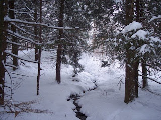
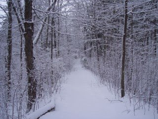 Last Weekend, I went on a snowshoe walk through the Eastern Blue Hills in Quincy after a moderate snowstorm. Conditions were perfect for snowshoeing, as the snow was light and powdery, so I set off that morning from the Shea Rink on Willard Street, starting on the Skyline Trail and soon moving on to the beautiful Sawcut Notch trail (see photo). The Sawcut Notch was in great condition and was mostly pretty level, so it was easy going for the first part of the hike.
 After awhile, the Sawcut Notch Trail started to rise a bit as it approached a scenic and remote hill called Great Dome. I skirted Great Dome--there is a trail that goes up the hill, but it is being phased out--and headed toward Little Dome and some marshy areas, taking some pictures of streams and wetlands along the way (see photo). A short ways after Little Dome, I took a left and found my way to Crags Foot Path, which is a peaceful, mostly level trail (and was particularly beautiful that morning).
 I hadn't really done any elevation gains up to this point, so just after the Furnace Brook Path veered off to the left, I took a right up a little-used path, scampering up the side of Rattlesnake Hill. The path soon brought me to the Skyline Trail once again, where I took a right and carefully hiked up the side of Rattlesnake Hill. When I got to the top, it started to snow, making for a really nice scene (see photo). I spent a few minutes at the top before retracing my steps and taking the Skyline Trail back to the parking lot.
 A group of us went on a nature walk around Little Blue Hill in the extreme western section of the Blue Hills Reservation in Canton over the weekend. Much of the vast Blue Hills Reservation (especially the Milton section) is popular with hikers, but the extreme east section (near the Shea Rink in Quincy) and the extreme western section (Little Blue Hill) aren't as popular. But both areas are quite scenic, with the Little Blue Hill area having a variety of features, including streams (see photo), hilltop views, and pristine woods.
 We more or less took a counter-clockwise route around the base of Little Blue Hill, starting out by taking a right at the end of the parking lot just south of the Trailside Museum on Route 138. We wound our way up gradually, coming to a beautiful view looking west from the shoulder of Little Blue Hill. From there, we dropped down and walked past some meadows and fields (see photo) and along some little-known paths before turning around near the Route 128/95 intersection. From there it was a quick walk back to the parking lot. This section of the Blue Hills is cut off from the rest--and isn't a huge area--but is a perfect spot for a short walk along some peaceful paths.
 We did such a trip recently, starting at the Lincoln Public Schools just off Lincoln Road near the center of town. From the parking lot near the tennis courts (hikers are allowed to park here), we walked north past the school fields and into a beautiful meadow area, eventually reaching a wooded trail that kept close to Sandy (Flint's) Pond. After awhile, we turned left, crossing Sandy Pond Road and working our way up to the top of Pine Hill, where we were awarded with limited, though pleasant views to the west (see photo).
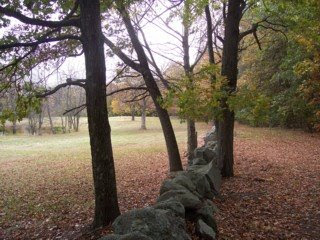 From Pine Hill, we wound our way down to the bottom near Walden Pond, then walked around the hill and back over to Sandy Pond. We walked around most of the rest of the pond, stopping for lunch at a scenic overlook above the pond and just below the DeCordova Museum. After our break, we continued up the fairly steep trail, skirting the museum, and heading east a few hundred yards, where we were treated to a remarkable view of fields, meadows, and rolling hills that felt more like Vermont than the Greater Boston area (see photo). From here, we headed south down a trail that was steep in a couple of spots, ending up back at the meadow just north of the school. From here, it was a short walk back to the parking lot.
 The Middlesex Fells Reservation is a popular hiking area north of Boston. Its deep woods, moving streams, and views from open hilltops make the Fells a favorite destination for walkers, whether they go to the Winchester, Medford, Malden, Stoneham, or Melrose section (or all of the above). Some parts are better known than others, however, and one of the least known parts of the Fells just happens to be one of the most popular recreation areas in Medford. Confused? Read on to find out more....
 Wright's Pond is located in the eastern part of the Middlesex Fells, wedged between Route 93 and Route 28, Elm Street, and Woodland Road. And while the beach area of Wright's Pond gets very crowded during the summer, much of the rest of the pond (which is actually manmade) is quite pristine. And since it is not really on any through trails in the Fells, it is often overlooked by hikers. One way to get to Wright's Pond is by parking in the Flynn Rink parking lot on Woodland Road, then walking along the Cross Fells Trail past Quarter Mile pond and up and down some low hills. At a rock outcropping perhaps 10 minutes from the parking lot, take a left down into the woods. From here, it gets a little confusing since the trails are mostly unmarked, but once you see the northern edge of the pond through the woods, try to stay on the trail that heads to the left shore. Once you get to the pond, you will soon find a rocky ledge above it that has outstanding views (see photo). This is a popular lunch spot among hikers.
 From the ledge, continue along the trail that goes alongside the pond, and keep bearing to the right whenever you can. Soon you will reach the beach at Wright's Pond (see photo). If you go during the summer, it will most likely be crowded, but most of the rest of the year it is quiet. From the beach, continue along the pond, heading clockwise around it until you come nearly to the trail that you first saw the pond. From here, continue on until you reach the Cross Fells Trail and head back to the parking lot, or if you want a longer hike, take a left on the Cross Fells Trail into the western part of the reservation or go straight which will take you to Spot Pond.
 At just under 500 feet above sea level, Buck Hill isn't the highest point in the Boston area, but it certainly has some of the best views. A favorite of hikers in the Blue Hills reservation, Buck Hill is one of the most rugged spots in this hilly, wooded area south of Boston. The summit of this broad, round hill is mostly treeless, allowing for nearly 360-degree views including the the Boston skyline and the ocean.
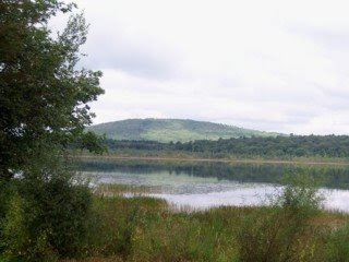 There are relatively few trails in the Ponkapoag area, with the most popular trail being the loop that goes around the pond. Access to this trail can be found at the Ponkapoag Golf Course, which has a parking lot that hikers can use. Starting at the clubhouse, hikers can walk along the main road through the golf course, reaching the pond after a few minutes. From this point, folks can go either clockwise or counterclockwise; to go counterclockwise, continue straight along the trail (rather than turning left) where the golf course ends and the pond begins. The trail here is mostly wide and flat, and after about a mile, a remarkable view of Great Blue Hill from the pond (see photo) can be had from a small beach. From this point, hikers can continue along the lake, eventually turning left and coming to the Ponkapoag Camp where cabins can be rented on or near the pond. This is a perfect spot for lunch, as there is a boardwalk below the cabins that extends a short distance out into the pond and a number of picnic tables up on the hill where many of the cabins are.
 From the Ponkapoag Camp, the trail continues near the pond for the most part and gets a bit hilly (there are also a few trails that veer off to the right in this area, mostly meandering through the woods). About a half mile before the trail meets up with the beginning of the loop by the golf course, there is a boardwalk that extends a good ways out into the pond by way of wetlands and marshes (see photo). This boardwalk is a must-see as long as the water isn't too high; if it is, the boardwalk can sometimes be under water in parts, and a bit dangerous as it becomes slippery. The boardwalk goes on for about a quarter mile, stopping at a spot with nice views of the lake. After backtracking to the main trail, it is an easy, mostly level walk back to the start of the loop and the road through the golf course that heads back to the parking lot.
 Great Brook Farm State Park in Carlisle, MA, is one of the true gems of Eastern Massachusetts. It is a vast area that includes deep woods, low hills, farmland, meadows, streams, and beautiful bodies of water such as Meadow Pond (see photo). Great Brook Farm is also a four-season recreation area, as it has cross-country skiing and snowshoeing in the winter, and hiking and horseback riding for much of the rest of the year.
 The trail network at Great Brook Farm State Park is extensive, allowing outdoors lovers to really get deep into some rugged land here. One particularly scenic loop is to start at the Hart Barn and Ski Center at the Lowell Road parking lot, and head clockwise along a number of trails, including the Lantern Loop, and Litchfield Loop, and the rugged Stone Row trail. From here, a short side trip can be taken north into Chelmsford, where a trail runs alongside the serene Russell Mill Pond (see photo). From this short spur, hikers can continue on to the Woodchuck Trail and the Garrison Loop, where there are a few historic sites to be seen.
 From the Garrison Loop, hikers can turn left and cross North Road, taking the mostly level Pine Point Loop around Meadow Pond. A couple of interesting side trails with water views branch off of the Pine Point Loop, including the Beaver Loop and the Keyes Loop. Just before the Pine Point Loop enters a meadow area (where other trails can be taken back to the parking lot), a tree-shaded area around a boathouse (see photo) affords great views of the pond, and is an excellent place to have a picnic lunch. From here, it is an easy walk back to the parking lot.
 Locke Pond is a bucolic, remote-feeling body of water in the Whipple Hill Conservation Area that straddles Winchester and Lexington. Many people who hike around Whipple Hill never even make it down to Locke Pond, as the sweeping views from the hill are often enough for folks who come to this rugged area northwest of Boston.
  One particularly nice approach to Locke Pond is from the aforementioned Whipple Hill. Park at the little pulloff on Johnson Road right where Winchester and Lexington meet, hike the few hundred feet up to the top of Whipple Hill, then go left from the summit, descending into the woods along a switchback trail that eventually straightens out, ending at a ravine just north of the pond. From here it is a very short walk to Locke Pond, where a number of trails afford excellent views.
 Earlier this year, I touched upon the Neponset River greenway in a blog entry about Lower Mills and Milton Landing. Both of these places are near the western end of the greenway, and are perhaps the most interesting parts of the path. But there are other interesting parts of the Neponset River Greenway, starting with the eastern end at Pope John Paul II Park in Neponset, as well as the extensive wetlands and meadows (see photo) near the Neponset/Milton border.
 From Pope John Paul II Park and the wetlands shown above, the Neponset River Greenway moves west into a slightly more wooded (and at times residential) area. The Red Line crosses the path, following it all the way to Milton Village and the Lower Mills section of Dorchester (see photo). This section of the greenway includes views of historic factories and other buildings, a dam, and a particularly fast-moving part of the Neponset River. From here, the Neponset River Greenway heads west for a little bit before ending at Central Avenue on the Milton/Boston border.
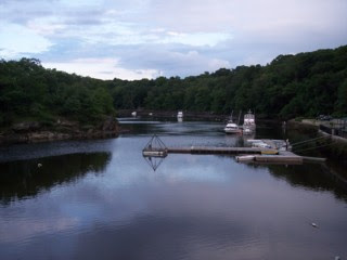 As mentioned in the earlier blog entry, a slight side trip can be taken from the Neponset River Greenway near Lower Mills and Milton Village. Milton Landing (see photo) is a calm, peaceful area just down the hill from Milton Village that has beautiful water views from the walkways around this area. The walkways at Milton Landing don't really go anywhere, but instead meander around, ending in spots and looping in others. From this area, it is easy to get back to the greenway and head back to Pope John Paul II park, where a vast network of trails and paths that await folks who wish to continue on.


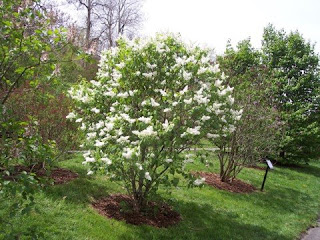
 Most people in the Boston area think of Stoneham and Medford simply as bedroom communities north of Boston, but for those who love outdoors, a good chunk of these two communities is considered prime hiking territory, thanks to the area known as the Middlesex Fells Reservation. The eastern part of the Fells (the part east of Route 93 that is mostly in Stoneham and Medford) is a bit smaller than the western part, but some of the most beautiful parts of the reservation are here, including a number of rocky hills, the scenic High Service Reservoir (see photo), and some of the most pristine woods inside Route 128.
 Several of us explored a large section of the Eastern Middlesex Fells over the weekend, enjoying the deep blue skies and mild late winter weather. We started at the Flynn Rink on Woodland Road in Medford and proceeded up to the aforementioned High Service Reservoir before descending into a beautiful wooded ridge with a stream running through it (see photo) before heading north into an area of low hills and pine forests.
 Leaving the woods near the Stone Zoo on Pond Street in Stoneham, we briefly hiked near the road before re-entering the woods and ascending a rocky trail that afforded tremendous views of Spot Pond (see photo). The trail continued over several ledges before dipping back into some deep woods and continuing south, eventually bringing us back to the serene Quarter Mile Pond and the Flynn Rink.
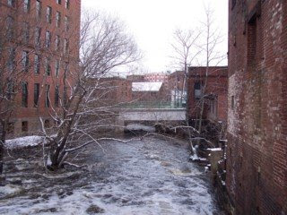 Several of us took a walk along the Neponset River Greenway over the weekend, spending a good amount of time near the end of the greenway around Lower Mills in Dorchester, Milton Village, and Milton Landing. This area include one of the most scenic and historic parts of Boston, with the Neponset River (see photo) roaring its way toward the ocean, and making a natural border between Milton and Dorchester.
 We wandered around the Dorchester side of the Neponset River for awhile, taking a look at the many historic buildings and structures there, including the old Bakery Chocolate Factory (see photo), which has been converted into apartments and condos. Lower Mills itself is a gem of a neighborhood, with interesting shops, old-fashioned streetlights, old brick buildings, and a real community feel. We walked along Dorchester Avenue (the main street of Lower Mills), soaking in the history and character of this great section of Boston.
 Before heading back to the parking lot at Pope John Paul II Park in Neponset, we spent a little time on the Milton Side of the Neponset River, walking through Milton Village and heading down to Milton Landing (see photo). Hidden away on a dead end street, Milton Landing is a quiet, peaceful spot with outstanding water views and pleasant walkways that go in various directions. Milton Landing is in the process of being renovated and redeveloped, with many condos there having sweeping views of the water below. There was virtually nobody out when we arrived at this area, so we pretty much had the walkways to ourselves. We stopped for a few minutes to enjoy the serenity of the spot before heading back to our cars, knowing we'd be back sometime in the summer to do more exploring in this interesting area just south of Boston.

