
A Boston-based journal with descriptions and photos of hiking areas in the Boston area, including challenging places to hike, as well as areas geared toward easy hikes.


 We started out by going up to Dungeon Rock (which is near the Pennybrook parking area). There is a long cave--or perhaps more accurately, a tunnel--that we went into for a bit. It was dark and slippery, so we didn't make it that far, but it was very interesting.
 From Dungeon Rock, we skirted Breed's Pond, eventually ending up at Burrill Hill, which has a stone tower, then over to Mount Gilead, which has a steel tower. Mount Gilead's views were better than those at Burrill Hill, with a particularly nice view of the Boston skyline.
 We dropped down to Walden Pond (no, not the one in Concord!) and had lunch at a peninsula on the western end of the pond. The pond is very peaceful and placid, with few people around, making it a nice lunch spot.
 After lunch, we hiked over to Mount Moriah, then took the beautiful Undercliff Path back toward the Pennybrook lot, but before we did, we hit Lantern Rock near the parking lot, which has breathtaking views of Breed's Pond from the top. Then it was back to the lot as we called it a day.


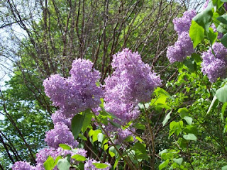
 A group of about 15 of us hiked through the Arnold Arboretum in Jamaica Plain, MA, several weeks back. It just happened to be the day before Lilac Sunday (which is held on Mother's Day), so we lucked out by getting to see lilacs in bloom without dealing with the crowds. Most lilacs that we saw were on the first part of the hike near Bussey Hill (see photo), with lilacs seemingly everywhere along the north side of the hill.
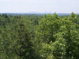
 As we hiked around, then up, Bussey Hill, we noticed many other plants and trees in full bloom in addition to all the lilacs. The colors seemed to be particularly spectacular this year. We wandered up various trails, finally reaching the top of Bussey Hill, taking in the beautiful views of the Blue Hills and the surrounding area from the partially open summit (see photo). After spending some time at the top of the hill, we wound our way down some trails, reaching the bottom of the hill near the Conifer Path. Most of the trees along the Conifer Path seemed to be healthy, though we did see a couple of larger pines that seemed to be either diseased or simply getting up there in age.
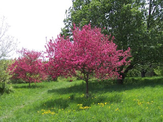
 From the Conifer Path, we crossed the street to the other side of the Arnold Arboretum, gradually heading around Peters Hill before going up to the top. From the summit of Peters Hill, we could see the Boston skyline as well as much of the Arboretum in the foreground, making for an interesting scene (and a good place to stop for a bit). The north side of Peters Hill has many fruit trees, some of which were in bloom (see photo), so we took a few trails along the side of the hill before heading back to the bottom.
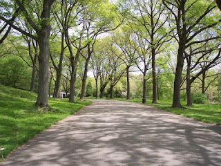
 After reaching the bottom of Peters Hill, we took one of the main roads in the Arboretum (they are all closed to traffic, by the way), including a remarkably scenic stretch (see photo) before jumping onto a trail and heading back across the street to a trail that led up the little-known Hemlock Hill. We spent some time relaxing there, again enjoying the views of Boston in the distance. Then we headed down the hill and took a trail through an area of beech trees before taking our final trail, which led us through willow trees and maple trees. It was the end of what must have been one of the most scenic hikes I've taken in 2007. Hopefully I'll get back in the fall to see some of the foliage there.
 Great Meadows is an area of meadows, woods, and low hills that sits within the town of Lexington, but it actually owned by Arlington. Nearly 200 acres in size, much of Great Meadows is inaccessible, as it has no real trails and is mostly wetlands (see photo). There is, however, as series of trails mostly around the perimeter of Great Meadows, and it is possible to use trails and side streets to complete a loop around the area.
 A trail starts from the Minuteman Bike Path, in East Lexington just behind the intersection of Routes 4/225 and Massachusetts Avenue. This trail shifts between level boardwalks (see photo) and hilly dirt trails, going counter-clockwise around the west side of Great Meadows. Following the main trail, it eventually goes past some beautiful strands of birch (see photo below) for a short time before going up a hill with scenic views of the meadows as well as Lexington.
 From the top of the hill, the main trail drops into some deep woods, then skirts a school and eventually ends at a side street. By following a series of side streets back toward the bike path, the loop can be completed. One option is to take a right on a side trail off one of the side streets, which leads to a remarkable view of the meadows from its eastern edge. That trail then continues south to the bike path.